
Spring River, Arkansas: Cold Water, Clear Rapids and Easy Floats
By admin
Dip your hand into the Spring River on a sticky August afternoon and you will pull it back out with a gasp. The air may be pushing ninety, but the water is cold enough to make you laugh, and so clear you can count the stones on the bottom. That cold, steady water sets the Spring River in Arkansas apart from almost every other stream in the region, and it shapes everything about how you enjoy it, from the summer floats to the winter eagles. It also fits neatly into a few easy days on Crown Lake in Horseshoe Bend.
One Enormous Spring Feeds the Whole River
Plenty of Ozark rivers, the Buffalo among them, rise and fall with the rain. The Spring River starts at Mammoth Spring, right by the Arkansas-Missouri line, and the Arkansas Game and Fish Commission puts the spring’s output at approximately 9.8 million gallons of 58-degree water every hour. That water fills a 10-acre lake held by a small dam inside Mammoth Spring State Park, then spills out to become the river.
So the river runs cold and clear all year. Arkansas Tourism calls it “ripe for year-round floating and fishing,” and in high summer, when other streams in the region shrink to a trickle between gravel bars, the Spring River keeps moving.
From the spring, the river flows about 75 miles to the southeast, according to the Encyclopedia of Arkansas, passing through Fulton, Sharp and Lawrence counties before emptying into the Black River near Black Rock.
Lively Shoals and Lazy Pools
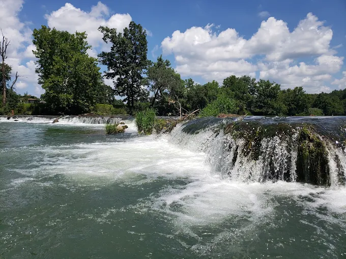
The upper river has a playful rhythm. The Encyclopedia of Arkansas describes numerous rocky rapids and several waterfalls there and advises traveling it with care. Arkansas Tourism describes whitewater drops that give way to long, lazy pools, with some stretches where the steady current does most of the work for you.
That mix is why the upper river is so popular for swimming and canoe trips. The shoals bring just enough excitement to keep everyone grinning, then a quiet pool lets you drift, look up at the bluffs and let your heart rate settle. Whoever is steering should still give the small falls their full attention.
The flow is remarkably steady. The AGFC notes that discharge generally ranges from about 206 to 694 cubic feet per second, with the river stage usually between about 4.0 and 5.3 feet. U.S. Geological Survey gauges at Mammoth Spring and below the river’s Dam #3 report real-time conditions if you want to check before you go.
A Valley With a Long Human Story
The Encyclopedia of Arkansas notes that settlement in the valley began after the War of 1812, and the land was being farmed before the Civil War. The big change came between 1881 and 1883, when rails for the Kansas City, Springfield and Memphis line were laid through the valley and development followed close behind. Small towns still sit along the river today.
The river has a wild side as well. Major floods in 1915, 1982, 2008 and 2025 damaged homes and bridges, and some proved fatal. Respect the water, especially after heavy rain.
We’d love to be your home base for exploring the rivers and lakes of north central Arkansas. Lodging guests at Crown Lake Resort have the lake at their doorstep, soft sand to stretch out on and a heated indoor pool for cool evenings. Have a look at our cozy cabins, or call the front desk on 800-872-3301 and we’ll help you pick one.
The South Fork Has a Different Temperament
Not all of the Spring River’s water comes from the big spring. The South Fork flows east from near Salem and joins the main river several miles downstream. Because Mammoth Spring doesn’t feed it, its volume rises and falls with the weather. The Encyclopedia of Arkansas notes it can be too low for canoeing in late summer and early fall, though its gravel bars are pleasant for camping and picnics. Check recent rainfall before you count on paddling it.
How the River Changes With the Seasons
Spring brings fresh green leaves along the banks and higher water after rain. Check conditions after storms.
Summer is peak season. Arkansas Tourism pitches the river as a summer escape for when the heat cranks up, and weekends can be lively, with rafts and canoes crowding the popular stretches. Go early or midweek for a quieter day.
Fall brings cooler air, warm colors in the trees and fewer people, and the main river keeps running strong even when other streams are low.
Winter is quiet and striking. The AGFC’s Spring River WMA page notes that bald eagles can be seen along the river in late winter, and anglers come for the cold-water fishing. Dress warmly: the water leaves the spring at 58 degrees, and the air can be colder still.
Where the Public Can Reach the Water
- Mammoth Spring State Park at the headwaters lets you see the spring and the lake it creates. It sits right by the state line and is the natural place to start learning about the river.
- Harold E. Alexander Spring River Wildlife Management Area, south of Hardy, has a boat ramp built in the mid-1990s that gives public access to the river. Anyone 16 or older using an AGFC wildlife management area needs a hunting or fishing license or a WMA/Lake Conservation Permit. The WMA also has a short trail along Rock Creek to Bubbling Springs, five primitive camping areas and some of the most diverse plant life in the state, with 812 documented plant species.
- Loberg Park in Hardy has a lighted, paved walking and biking trail along the river, made for a gentle evening stroll.
At any other landing, follow posted rules and get permission where needed.
A Quick Word on Fishing
Cold, steady water lets trout be stocked here year round, as the Encyclopedia of Arkansas points out, and the AGFC’s managed trout section runs about 12 miles downstream from the spring. Farther down, Arkansas Tourism notes walleye and smallmouth bass in the deeper runs. Check the AGFC’s current license and trout permit requirements before you wet a line.
River Days From Crown Lake
The Spring River is the kind of place you visit more than once, and Crown Lake Resort in Horseshoe Bend makes a comfortable base for it. After a chilly day on the water, the sauna and hot tub bring the feeling back to your toes, and when nobody wants to cook, Papa Dick’s is right on the property.
At the RV Resort, campers can rent a canoe or kayak for a practice paddle on the lake before tackling the river shoals, then plug into full hookups once the sun goes down. Before you arrive, explore the property to get a feel for the trails, beach and docks.
Give our front desk a call on 800-872-3301 and we’ll gladly help you plan your river days. All our cabins, condos and lakefront stays are on the Crown Lake Resort website, so you can look around first.
Frequently Asked Questions
What river does the Spring River flow into?
The Spring River ends at its confluence with the Black River in Lawrence County. The Black River in turn joins the White River near Jacksonport, making the Spring River part of the larger White River basin.
What fish species can you catch in the Spring River?
The Encyclopedia of Arkansas notes that fly fishing for rainbow, brown and cutthroat trout is popular here. Lower down, walleye and smallmouth bass hold in deeper runs.
Are the caves near the Spring River open to explore?
Not on the Harold E. Alexander Spring River WMA. The AGFC has shut every cave there to the public to help stop the spread of white-nose syndrome, a disease that kills bats. You can still enjoy the area’s trails, river access and wildlife viewing.
Where does the water come up at Mammoth Spring?
Deep underwater. The Encyclopedia of Arkansas explains that the spring rises through a vent about 80 feet below the surface of Spring Lake, the small lake at the head of the river.
Does the Spring River ever flood?
Yes. Despite its steady spring-fed flow, the Spring River can flood after heavy rain. The Encyclopedia of Arkansas reports floods reaching thirty to forty feet above flood level, so check forecasts and river gauges after storms.
Greers Ferry Lake: A Day Trip Guide
Ninety-six steps stand between the Greers Ferry Lake visitor center and one of the best views over the Little Red River valley, and by the time you reach the top of the Mossy Bluff Trail you have forgotten every one of them. Below you, the Little Red runs cold and green away from the dam. Behind you, a lake of more than 30,000 acres fills the hollows of the Ozark hills. Greers Ferry Lake is a longer scenic drive south from Horseshoe Bend than some of the area’s other lakes, so it pays to plan the day around a few good stops.
A Dam With a Place in History
Greers Ferry Dam sits about three miles north of Heber Springs in Cleburne County, on the Little Red River at the foot of Round Mountain. It was completed in 1962, standing 243 feet above the old streambed and running 1,704 feet across.
On October 3, 1963, President John F. Kennedy came to dedicate it. The Encyclopedia of Arkansas notes that it was one of his last major public appearances before his assassination the following month, and knowing that gives the dam site a weight you can feel when you stand there.
The lake covers 30,000 to 40,000 acres depending on the water level, with more than 340 miles of shoreline across Cleburne and Van Buren counties. Like its neighbors to the north, it was built mainly for flood control and also generates hydroelectric power. The Little Red River leaves the dam and eventually joins the White River near Georgetown.
Stop One: The Visitor Center and Dam Site
Begin at the William Carl Garner Visitor Center near the dam, with the Mossy Bluff trailhead just outside the door. Pick up a lake map and ask staff which parks and swim areas are open, since that can vary with the season and the water level.
The Buckeye National Nature Trail makes a gentle warm-up. It is only 660 feet long, with a smooth surface designed for wheelchairs, two picnic tables and two vista points looking over the area below the dam. Brochures in large print and Braille are available at the visitor center, so grandparents and anyone who needs an easier path can enjoy it too.
Stop Two: Mossy Bluff Trail
Next comes the Mossy Bluff Trail, a 1.6-mile round trip of about 45 minutes. According to the Corps of Engineers hiking page, the path follows a wooded bluff high above the river just downstream of the dam. Watch for two trees that have grown together, lichens slowly breaking down the rock, and a balanced rock left behind by weathering. Then come the 96 steps to the overlook, where the river and the Greers Ferry National Fish Hatchery spread out below.
The U.S. Fish and Wildlife Service runs that hatchery, and most of what it raises are rainbow trout for the cold water the dam created downstream.
It’s a long day on the road, so we’ll make sure the evening is an easy one. Lodging guests at Crown Lake Resort come back to a warm pool, a hot tub and a quiet beach. Our condos give a family room to spread out, and the front desk at 800-872-3301 is glad to help you find a good fit for your group.
Stop Three: Collins Creek and the Little Red River
Below the dam, the Collins Creek Trail follows a stream for about 3,000 feet, and part of it is accessible for wheelchairs. The creek is partly engineered. A pipeline carries cold lake water from the dam to keep it flowing year round, and rock riffles were built to form pools where trout can reproduce. It is a quiet, shady walk and a close look at how the lake shapes the river below it.
If you want to get closer to the Little Red, remember that water below a hydropower dam rises and falls with releases. The Corps explains that rainfall and demand for electricity determine those releases, so check current conditions before wading or launching a boat.
Stop Four: An Afternoon at a Lake Park
By early afternoon it is time for the water. The Corps of Engineers operates eighteen parks around the shoreline, with campgrounds, boat launches and swim areas spread across the lake. The Corps calls Greers Ferry “a playground for all kinds of water sports,” and on a summer afternoon swimmers, paddlers, skiers and pontoon boats all share the same water.
For a longer leg stretch, the Josh Park Memorial Trail in Dam Site Park runs 6,485 feet from a trailhead off Highway 25B North, just north of Heber Springs. The trailhead has a vault toilet, drinking water, a picnic area and a fitness station.
A Bonus for Boaters: Sugar Loaf Island
If you have a boat, the Sugar Loaf trail is a memorable extra. It climbs an island on the western end of the upper lake and can only be reached by water. A courtesy dock and trail map sign greet you at the start, and the 1.6-mile round trip takes about two hours with rest stops. The island is a game refuge with varied plant life, sandstone formations more than 300 million years old and wide views over the lake. Spring brings wildflowers, summer is prime hiking season, and the fall color is worth a second climb.
Staying Safe on and Around the Lake
State wildlife officials at the Arkansas Game and Fish Commission remind boaters that state law calls for a life jacket within reach of everyone aboard, that kids must keep theirs on, and that a jacket only saves you if you are wearing it. Swim only in designated areas, with a buddy, and stay within arm’s reach of young children at the water’s edge. On hot days, carry more drinking water than you expect to need, and plan for shade in the middle of the afternoon.
Since the drive back to Horseshoe Bend is a long one, start early and leave time to make the return trip in daylight. Rural Ozark roads are beautiful, and winding.
Ending the Day at Crown Lake
After a big lake, a smaller one is a pleasure. Crown Lake is small enough to feel peaceful, and bald eagles often patrol its shoreline. If the drive has left anyone stiff, L’Aura Spa & Wellness offers massage therapy, reflexology and paraffin dips right on the property, and Papa Dick’s Restaurant and pizzeria takes care of dinner.
RV travelers can pull straight into one of 59 pull-thru sites at the RV Resort, with full hookups and WiFi waiting.
Our front desk is always glad to help you map out your days, so give us a call on 800-872-3301. You can compare every cabin, condo and lakefront stay and get a feel for the grounds on the Crown Lake Resort website before you ring.
Frequently Asked Questions
How many people visit Greers Ferry Lake?
The Encyclopedia of Arkansas reports that by 2000, more than 5.5 million people had visited the lake. Over the same decades, Cleburne County grew from about 9,000 residents in 1960 to more than 24,000 in 2000.
How many nature trails are at Greers Ferry Lake?
The Corps of Engineers lists Buckeye, Collins Creek, Josh Park Memorial, Mossy Bluff and Sugar Loaf among its trails at the lake. Several carry special designations, such as the Mossy Bluff National Natural Trail and the Sugar Loaf National Nature Trail.
Is Greers Ferry Lake part of the White River system?
Yes. The Corps runs Greers Ferry as part of a six-lake flood control system in the White River basin, alongside Beaver, Table Rock, Bull Shoals, Norfork and Clearwater lakes. Releases below Greers Ferry are based on river levels miles downstream of the dam.
Who built the Sugar Loaf trail at Greers Ferry Lake?
Staff from the Greers Ferry Project Office of the Corps built the Sugar Loaf National Nature Trail themselves.
Is Greers Ferry Lake known for big fish?
Very much so. The Corps of Engineers notes that the lake holds the world record walleye, at 22 pounds 11 ounces, and the state record hybrid striped bass. Downstream, the Little Red River tailwater held the world record brown trout, a 40 pound 4 ounce fish, from 1992 to 2009.
Bull Shoals Lake: What to Know Before You Go
Spread a map of Bull Shoals Lake across the kitchen table and the first reaction is usually a laugh. It hardly looks like a lake at all. It looks like a giant branching tree, with long arms and coves reaching into the hills of two states, and the hardest part of a first visit is deciding where to start. A little background helps: how big the lake is, how to pick a public park, why the water may not match last year’s photos, and the rules that keep a day on the water easy. Then you can head back to Crown Lake in Horseshoe Bend for a quieter evening by the beach.
Bigger Than It Looks on Paper
Bull Shoals Lake sits in the Ozark Mountains of northern Arkansas and southern Missouri, held back by Bull Shoals Dam on the White River. The lake and the public land around it are run by the U.S. Army Corps of Engineers, with tens of thousands of surface acres of water and a long list of public parks and access points.
The shoreline is where the scale hits home. According to the Encyclopedia of Arkansas, the lake has about 740 miles of shoreline at its normal conservation level and as much as 1,050 miles when the flood pool is full. It drains 6,036 square miles of the Ozarks. The Corps adds that Bull Shoals is larger than Beaver and Table Rock lakes combined, its two upstream neighbors on the White River.
So don’t try to see it all. Pick one area, settle into one park, and save the rest for another trip.
Choosing a Public Park
The Corps runs a string of developed parks around the shoreline. Between them you’ll find campgrounds, boat launches, designated swimming areas, playgrounds and group picnic shelters. Some facilities charge a day-use fee, so check the details for your chosen park before you go.
Your plans for the day narrow the choice quickly:
- Bringing a boat: look for a launch ramp with room for trailer parking.
- Swimming as the main event: choose a park with a designated swim area, away from boat traffic.
- Spending a long afternoon: day-use areas with shade and picnic shelters keep everyone comfortable.
The Corps’ Bull Shoals Lake page lists its parks and campgrounds, and most campsites can be reserved through Recreation.gov.
Clear Water Is the Draw
The Corps describes Bull Shoals as “clear, clean and un-crowded,” and that clarity is a big part of its appeal. On a still day you can see deep into the water from a boat, and in many coves the wooded hills drop straight to the shore. Swimmers, paddlers and photographers all find something to love, and so does anyone content to sit on a point and watch the light change.
The lake is also famous for fishing, from warm-water species on the lake itself to the cold tailwater below the dam. Our other guides cover the trout water. This one stays on the lake.
Water Levels Change by Design
First-time visitors are often surprised by how much the shoreline can shift from one year to the next. The Corps explains in its White River FAQs that the White River basin lakes were built to store water for hydropower in average weather and to hold floodwater in wet weather. Lake levels therefore depend on the weather, running very high in unusually wet periods and very low in drought.
Bull Shoals plays a big part in that system. Its flood pool is 41 feet deep, and the Corps says the lake has more than twice the flood storage of Beaver and Table Rock combined. After heavy spring rains the lake may sit well above its normal level for months while stored water is let out at a controlled pace. In dry years, ramps and beaches can sit farther from the tree line than you remember. Check current lake levels on the Corps of Engineers water management site before your trip, and confirm that your park, ramp and swim area are open.
For a gentler pace, our beach will be waiting for you back in Horseshoe Bend. Lodging guests at Crown Lake Resort trade open water for soft sand and a warm hot tub once the sun goes down. Our beachfront stays put you steps from the sand, and the front desk at 800-872-3301 is happy to talk you through the options.
Simple Rules on the Water
Arkansas boating law is straightforward, and a few habits keep everyone safe on a lake this size.
Life jackets. Every person aboard needs a life jacket within easy reach, and kids have to wear one. According to the Arkansas Game and Fish Commission, the only exception is a houseboat or railed vessel sitting still, and even then children must wear their jackets once the boat moves under power.
Kayaks and canoes. Paddlers follow the same life jacket rules, and canoes and kayaks 16 feet and longer need a throwable flotation device aboard. Practice getting back into your boat in calm water before heading out into open water, and paddle with a partner if you are new to it.
Alcohol. Anyone drinking should hand the wheel to someone else. The AGFC warns that alcohol impairs judgment on the water just as it does on the road.
Swimming. Stick to designated swim areas, swim with a buddy, and remember that distances across open water are farther than they look.
Leave it better. The Corps asks visitors to leave each area in better condition than they found it, avoid damaging trees and plants, and dispose of all trash properly.
Bull Shoals Through the Year
Spring brings fresh green hills, wildflowers and the chance of higher water after rain, and it is a pleasant time for paddling and picnics before the summer crowds.
Summer is peak swimming and boating season. Arrive early to claim a picnic shelter, and plan for shade and plenty of water in the afternoon heat.
Fall turns the hardwoods along the shore gold and red, and cooler days suit hiking and long boat rides.
Winter is quiet on the lake, with a stark beauty to the bare hills. It is also when bald eagles winter in the White River region, so keep binoculars handy.
Coming Home to Crown Lake
After the wide-open feel of Bull Shoals, Crown Lake feels like a deep breath. At Crown Lake Resort, bald eagles are often spotted over the water, and the evening needs no car keys: a sauna before dinner, a few games in the game room, and dinner from Papa Dick’s right on the property. The explore the property page has everything else.
RVers have their own corner of the property at the RV Resort, with concrete pull-thru pads, full hookups at every site and the boat docks close by.
We’d love to welcome you to Horseshoe Bend, so call our front desk on 800-872-3301 whenever you’d like to talk dates. In the meantime, browse our cabins, condos and lakefront stays and picture your evenings on Crown Lake.
Frequently Asked Questions
Why was the dam built at Bull Shoals instead of Wildcat Shoals?
A 1930 Corps report recommended a dam at Wildcat Shoals, but a 1940 report moved the site to Bull Shoals because of unsuitable foundation conditions at Wildcat. Private power companies had explored damming Wildcat Shoals as early as 1902 but never started work.
Does the Corps of Engineers lower Bull Shoals Lake for recreation?
No. The Corps does not have legal authority to manage lake levels for recreation. Releases follow the White River Water Control Plan, and when the lake is at its normal level, the Southwestern Power Administration sets releases within limits that include a minimum release to help trout survive in warm months.
How much water can Bull Shoals Lake hold?
The Encyclopedia of Arkansas puts total potential storage at 5.76 million acre-feet. That huge capacity is why Bull Shoals is a cornerstone of the six-lake system that reduces flooding along the lower White River.
Does Bull Shoals Lake reach into Missouri?
Yes. The lake stretches from northern Arkansas into southern Missouri, and several Corps campgrounds on its upper end are near Missouri towns such as Forsyth and Branson. Check fishing license rules for the state whose water you are on.
Norfork Lake: A Day on the Water in the Arkansas Ozarks
Lower yourself off a swim beach on Norfork Lake and look down. The water is clear enough to see your toes, the hills around the cove are thick with oak and cedar, and the only sound is a boat somewhere far off down the main channel. Norfork Lake in north central Arkansas is big enough for a full day of boating and quiet enough that a shoreline picnic still feels private, which makes it an easy pick for a day away from Crown Lake in Horseshoe Bend.
A Lake Born From the North Fork River
Norfork came first among the big dams in this part of the White River system, finished before work on its neighbor at Bull Shoals even began. The dam sits on the North Fork River just upstream of where it joins the White River in Baxter County, and it takes its name from the nearby town of Norfork. Congress authorized it in the Flood Control Act of 1938, construction began in spring 1941, the lake started filling in 1943, and the dam and powerhouse were running by 1944.
The Encyclopedia of Arkansas describes a project of real scale for its day: a dam 2,624 feet long, built with about 1.5 million cubic yards of concrete by an average of roughly 815 workers over four years. The lake came at a heavy cost to local families. About 400 landowners had to relocate, some twenty-six cemeteries were moved, and farmland around Henderson in Baxter County and Bakersfield, Missouri, went under the water.
At its normal level the lake covers about 22,000 acres with 380 miles of shoreline, reaching north across Baxter and Fulton counties into Ozark County, Missouri. The U.S. Army Corps of Engineers manages about 32,000 acres of public land around it.
Choosing Your Kind of Norfork Lake Day
The Corps describes clear, uncrowded water and a wooded, mostly undeveloped shoreline. That combination suits several very different days out.
Swimming and a Picnic
Families can start with the designated swimming areas. The Corps lists swim areas at Gamaliel, Bidwell Point, Robinson Point, Panther Bay, Cranfield, Quarry and Jordan. Day-use fees apply at the designated swimming areas, so check the current rules with the Corps before you go. Pack a cooler, claim a picnic table and let the kids wade in at their own pace.
Out on a Boat
Norfork is a classic lake for sailing, waterskiing and slow pontoon afternoons. Public boat ramps sit in the developed parks around the shoreline, and the long arms of the lake mean you can find a quiet cove for lunch even on a summer weekend. Check the Corps’ Norfork Lake pages for ramp details before you hitch up the trailer.
Below the Surface
Norfork has a following among divers. The Corps notes that scuba divers come from across the central United States for the clear water, so certified divers should pack their gear.
On the Trails
The trails around the lake make a good change of pace from the water. The Corps lists the Robinson Point National Recreation Trail, the Norfork section of the Trans-Ozark Trail, and the Big Tree, Bidwell Point, Cranfield, David’s and Pigeon Creek trails. Spring wildflowers and fall color make those two seasons the prettiest for walking.
After a day on a big lake, a small one feels wonderful, and we’d be happy to have you. Everyone staying in our lodging at Crown Lake Resort gets a private lakefront and a white sandy beach. Our lakefront stays put you right by the water, and our team on 800-872-3301 will happily help you pick one.
Below the Dam: The Norfork Tailwater
The dam changed the river below it for good. Damming turned the tailwater into a cold-water environment, and the Norfork National Fish Hatchery was built below the dam in 1957 to stock trout and offset that change. The hatchery sits on 43.9 acres and is run by the U.S. Fish and Wildlife Service, and as of 2009 it was producing more than 500,000 pounds of trout a year for tailwaters in Arkansas and Oklahoma. Up on the lake, the Arkansas Game and Fish Commission began introducing striped and hybrid bass in the late 1970s, and the Encyclopedia of Arkansas calls Norfork a popular Mid-South fishing destination.
If the cold river below the dam tempts you, remember that water releases change its level, and check conditions before you wade.
Staying Safe on a Big Lake
Norfork is a friendly lake, but a big one. The Corps’ swimming safety guidance asks swimmers to stay where they know the depth and bottom, swim with a buddy, avoid diving, and keep clear of boat channels, launch ramps and docks. It also warns that distances over water are deceiving, so don’t overestimate how far you can swim. Keep a close eye on children the whole time.
On a boat, Arkansas law requires a life jacket on board and within reach for every person, and children must wear a Coast Guard approved life jacket whenever they are aboard, with narrow exceptions for railed boats that are not moving under power. The Arkansas Game and Fish Commission notes that several recent boating deaths in Arkansas happened when someone jumped overboard without a life jacket. Anyone who plans to drink should leave the driving to someone else.
Summer sun on open water is strong. Pack more drinking water than you think you need, and some shade.
Fitting Norfork Lake Into Your Stay
Norfork makes a satisfying day trip from Horseshoe Bend, especially when you have a few days to spread out. Many guests pair a big-lake day with a slower one at home.
At Crown Lake Resort, that slower day can be as simple as a morning on the beach, an afternoon in the heated indoor pool and sauna, and dinner at Papa Dick’s Restaurant and pizzeria without moving the car. Look up in the evening and you may spot one of the bald eagles that frequent the lake. The explore the property page shows everything else on site.
If you’re towing a camper or a boat, the RV Resort has concrete pull-thru pads with full hookups and boat docks right on Crown Lake.
If you’d like help planning a few Ozark lake days, give our front desk a call on 800-872-3301. We’re glad to talk through our cabins, condos and lakefront stays and find the right fit for your group.
Frequently Asked Questions
How big does Norfork Lake get when it floods?
At the top of its flood pool, Norfork Lake can grow to about 30,700 acres with 510 miles of shoreline, according to the Encyclopedia of Arkansas. That is a big jump from its normal size of about 22,000 acres.
How many parks are around Norfork Lake?
The Corps of Engineers maintains seventeen parks around Norfork Lake. Developed parks offer campsites ranging from rustic to modern, some with electrical hookups, along with playgrounds, group picnic shelters, swimming areas and boat ramps.
Can you hunt on public land at Norfork Lake?
Yes. The Corps of Engineers notes that public land around Norfork Lake is open for hunting white-tailed deer, wild turkey, squirrel, rabbit, quail and migratory birds such as doves, ducks and geese. Arkansas and Missouri hunting regulations and licenses apply.
How does Norfork Dam help with flooding?
Norfork is one of six White River basin lakes the Corps operates together to reduce flood damage. The Encyclopedia of Arkansas reports that between February 1945 and April 1947, Norfork cut the 18 highest flood crests at Calico Rock by an average of 3.31 feet.
Is Norfork Lake the same as the North Fork River?
Not quite. Norfork Lake is the reservoir formed by damming the North Fork River, and the river continues below the dam for a short distance before it joins the White River near the town of Norfork.
Bull Shoals-White River State Park: A Visitor’s Guide
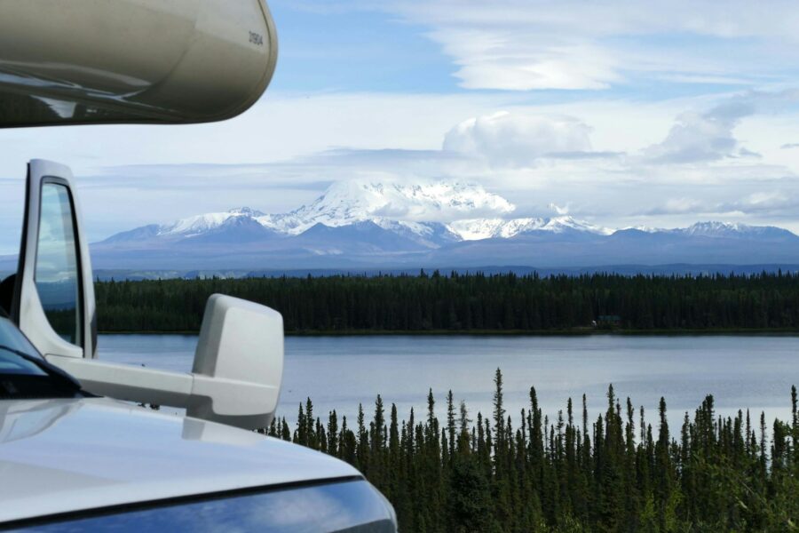
On a cold January morning, the observation deck above Bull Shoals Dam is one of the best seats in the Ozarks. Below you, the White River slides out of the dam in a green ribbon with mist hanging on the water, and if you are patient a bald eagle will cruise past at eye level. Bull Shoals White River State Park wraps around that scene, from the visitor center high on the bluff down to the campsites and trails along the river. Taken from top to bottom, it makes a full and easy day trip from Crown Lake in Horseshoe Bend.
A Park Built Around a Giant Dam
The dam came first. Construction on Bull Shoals Dam began in 1947, and when it was finished it was the fifth largest dam in the country. The Encyclopedia of Arkansas puts it at 2,256 feet long and 256 feet tall, built with 2.1 million cubic yards of concrete, and its powerhouse was once the largest building in Arkansas. President Harry S. Truman spoke at the dedication on July 2, 1952.
The state park followed soon after. In 1955 Arkansas leased the undeveloped land below the dam from the U.S. Army Corps of Engineers, making it the seventh park in the state system. It now covers 732 acres in Baxter and Marion counties, along the shores of both Bull Shoals Lake and the White River.
The name has a story too. Early French trappers called the area’s big springs “boill,” and the word drifted into English as “bull,” which is how the shallow, swift water here became Bull Shoals.
Start at the Top: The James A. Gaston Visitor Center
Begin at the James A. Gaston Visitor Center, a 15,744-square-foot building perched above the dam at 153 Dam Overlook Lane in Bull Shoals. According to Arkansas State Parks, its exhibit hall and theater tell the history of the area and the fishing stories that made these waters famous. There is an observation tower and a gift shop, and from the windows you can see the river, the dam and the lake at once.
Give yourself an hour. Children tend to be awed by the sheer size of the dam once they see it laid out below them. The visitor center has no camping access: the campground is down in the main part of the park along the river, with its own address in Lakeview.
Down by the River: Camping and the Park Store
The heart of the park lies along the White River below the dam. The campground has 109 sites, including 63 Class AAA sites, 26 Class B sites and 20 tent sites without hookups, plus three Rent-An-RV sites for people who want to try camping without a rig of their own. The state paved the campsite pads in 1998, which keeps things tidy in wet weather.
The park’s riverside store rents boats and carries bait, tackle and supplies, so you can spend a few hours on the water without hauling your own gear. Arkansas State Parks calls this the state’s premier park for trout fishing, and anglers travel a long way for its cold, clear tailwater. Even a casual hour with a rod at the water’s edge is a fine way to spend a morning here.
After a day at the dam, we’d love to welcome you back to a quieter lake. Lodging guests at Crown Lake Resort in Horseshoe Bend have their own stretch of sandy beach, plus an indoor pool and hot tub for evenings when the air turns cool. Our lakeview cabins look out over the water, and the front desk at 800-872-3301 will help you find the one that fits.
Hiking the Park’s Trails
The trails here are short enough to fit into a day trip and varied enough to keep everyone interested, and mountain bikers have room to ride too.
Big Bluff Trail
This 1.75-mile loop is rated moderate to strenuous and takes about two hours. The first stretch is a level walk along the remains of a railroad tram the Corps of Engineers built to haul steel and lumber in from Cotter for the dam. After it crosses the paved road, the trail climbs to an overlook of the White River, Bull Shoals Dam and the surrounding hills, then loops back through cedar glades, mature hardwood forest and small streams. The Arkansas State Parks trail description notes that these areas are excellent habitat for Ozark wildflowers, so spring is a beautiful time to go.
Lakeside Trail
For an easier walk, the Lakeside Trail is a one-mile loop in the lakeshore day-use area, built in 1979 by the Young Adult Conservation Corps. It takes about an hour. Two spots along it, Eagle Point and Titmouse Alley, are excellent for bird watching. In winter you can often spot bald eagles, waterfowl and gulls from Eagle Point, and in the warmer months more than 90 species of migrating and summer resident songbirds pass through.
Choosing Your Season
Winter is eagle season. The park runs eagle watches through January and February, when bald eagles winter in the area, and the views from the visitor center open up once the leaves are down.
Spring brings wildflowers along the Big Bluff Trail and songbirds along the lake, a good time for photographers and walkers.
Summer is busiest at the campground. Interpretive programs such as campfire cooking demonstrations, trout fishing workshops and guided nature walks keep families busy.
Fall means cooler hiking weather and color across the hills above the river, some of the most comfortable conditions of the year for a long day outdoors.
Staying Safe Below the Dam
The river below a hydroelectric dam behaves differently from a natural stream. The Corps of Engineers explains in its White River FAQs that rainfall and consumer demand for electricity determine how much water is released from the dams, through power generation, spillway gates or conduits. The level below Bull Shoals Dam is never fixed, and the water is cold year round.
If you plan to wade, fish from the bank or paddle, check the current release information on the Corps of Engineers water management website before you go, ask park staff about conditions, and wear a life jacket on the water. Watch the river while you are out, and keep children close to the bank.
An Easy Day from Horseshoe Bend
Bull Shoals White River State Park makes a relaxed day trip from Crown Lake Resort. Many visitors do the visitor center in the morning, a picnic and a short hike around midday, and an afternoon by the river before heading back to Horseshoe Bend. Families who want a slower pace can stick to the visitor center and the Lakeside Trail and be back at the resort in time for an afternoon swim.
Evenings at Crown Lake take care of themselves: a round of Safari Mini Golf, a game of shuffleboard, and a pizza from Papa Dick’s on the property. Campers can settle in at the RV Resort, where the pull-thru sites have full hookups. You can also explore the property to see the trails, beach and docks before you arrive.
Call our front desk on 800-872-3301 and we’ll gladly help you line up your dates with eagle season. You can browse our cabins, condos and lakefront stays or visit the Crown Lake Resort homepage to get a feel for the place first.
Frequently Asked Questions
Can you tour inside Bull Shoals Dam?
Not at this time. Public tours of the dam were halted after September 11, 2001, resumed in 2009, and ended again in May 2015, according to the Encyclopedia of Arkansas. The visitor center’s observation areas are now the best way to see the dam up close.
How many generating units does Bull Shoals Dam have?
Bull Shoals Dam has eight generating units with a total installed capacity of 361,000 kilowatts. Power generation began in September 1952, and the final two units were installed in 1963.
How much flooding has Bull Shoals Dam prevented?
The Encyclopedia of Arkansas reports that Bull Shoals Dam prevented an estimated 225.5 million dollars in flood losses through fiscal year 2009. It works as part of a six-lake system on the White River basin that the Corps of Engineers operates mainly to reduce flood damage downstream.
What happened to the old White River float trips?
The dam ended them. Before Bull Shoals was built, anglers took multiday fishing float trips down the White River from Branson, Missouri, to Cotter, and the lake and cold tailwater replaced that way of fishing with the trout fishery the area is known for today.
Where is the Bull Shoals White River State Park campground?
The campground is in the main riverside section of the park at 129 Bull Shoals Park, Lakeview, AR 72642, separate from the visitor center up on the dam. Double-check which address is in your map app before you set off, so you land at the right part of the park.
Batesville, Arkansas: A Day Trip to the State’s Oldest Existing City
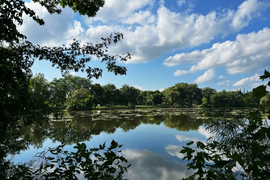
By the fourth day of a lake vacation, somebody usually asks what else is around. The kids have had three straight days of beach and pool, or the forecast promises a gray morning that clears by lunch. Point the car toward Batesville, Arkansas, a White River town with a historic Main Street, a regional museum and riverside parks, and you can still be back at Crown Lake in Horseshoe Bend for an evening swim.
How a River Bend Became a City
Batesville’s story starts with water. According to Arkansas Tourism’s Batesville guide, a single log cabin went up in 1804 where Poke Bayou meets the White River. A settlement and trading post grew around it, and the town was laid out in 1821. It went by three names over the years, Napoleon, Poke Creek and finally Batesville, after Judge James Woodson Bates, Arkansas’s first territorial delegate to Congress. The City of Batesville calls itself the oldest existing city in Arkansas, and you will hear that point of local pride more than once.
The first steamboat, the Waverly, tied up in January 1831, and for roughly seven decades White River steamboats drove the town’s growth. The Encyclopedia of Arkansas notes that many of those boats were owned and run by local people, until the railroads arrived and river traffic faded. Batesville also came through the Civil War with its buildings intact while many Arkansas towns were damaged, which goes a long way toward explaining why the old streets look the way they do. Today it is the seat of Independence County.
Morning: Walk the Historic Main Street
Start downtown, where the history is easiest to read. Batesville has two historic districts, with Victorian-era homes at their heart, and the Batesville Historic Residential District is centered on Main Street. A fire in 1920 destroyed forty houses and other downtown buildings, so the homes that survived are treasured. Arkansas Tourism points out that you can find residential architecture from every decade since the 1840s here, which turns a slow walk into a timeline in brick, clapboard and porch trim.
Look for two houses by name. The Maxfield-Garrott House on Main Street, built in the early 1840s, is described as the oldest home in town. The Cook-Morrow House, from 1909, shows the town in its early twentieth-century prime. Both are on the National Register. They are private homes, so admire them from the sidewalk.
Downtown also has commercial buildings on the National Register, and a local Main Street program works to preserve the original business district. Wear comfortable shoes and give it an unhurried hour.
Late Morning: The Old Independence Regional Museum
If you only go inside one place in Batesville, make it the Old Independence Regional Museum. Open since 1998, it covers Native American life in the region, early settlement and the Civil War, and Arkansas Tourism describes it as award winning. After the walk, it puts the river, the steamboats and the old houses into context, and curious kids get as much out of it as the history buffs.
Nearby, Bethel AME Church is the oldest religious structure in town and preserves the legacy of Batesville’s first Black congregation.
When you’ve had your fill of town, we’ll have the lake waiting for you. Lodging guests come back to Horseshoe Bend for a swim off the sandy beach or a long evening in the hot tub. Our condos include two-bedroom units that sleep six to eight, and the front desk team at 800-872-3301 is happy to help you pick one.
Afternoon: Parks Along the River and the Bayou
After lunch, head outside. Batesville’s parks show how closely the town has always lived with its waterways.
Riverside Park
Riverside Park runs along the White River and is the town’s main spot for outdoor recreation. In the holiday season the 35-acre park fills with millions of lights for the annual White River Wonderland, one reason Batesville calls itself the Christmas Capital of Arkansas. Seasonal extras have included carriage rides, ice skating, a Ferris wheel and free movies.
Kennedy Park and Polk Bayou Park
Kennedy Park is the local pick for sunset views. Polk Bayou Park sits near “The Rocks,” a natural swimming hole, and the bayou itself is a gentle paddling route that passes through countryside and downtown alike. Arkansas Tourism spells the waterway both Poke and Polk, so don’t be thrown if you see it written either way.
The White River
Public ramps give anglers easy access to the White River. Around Batesville the river is known for walleye, catfish and bass, while the colder water upstream is trout country. Even if you don’t fish, stand on the bank for a few minutes and picture the steamboats that once tied up here.
Late Afternoon: Lyon College and the Bluff Trail
Lyon College began in 1872 as Arkansas College, founded by the Presbyterian Church, and is now a nationally ranked liberal arts college with a handsome campus. Visitors can stretch their legs on the Lyon College Bluff Trail, which is open for hiking and mountain biking. In October the college hosts the Arkansas Scottish Festival, with Highland games, Celtic music and Scottish food, a fine excuse for a fall day trip.
Climbers can look south of town to Jamestown Crag, where Atoka sandstone holds more than 100 bolted routes. It hosts a fall climbing competition and fundraiser called King of the Crag.
Planning Tips for Your Batesville Day
- Check event dates first. The Scottish Festival and the holiday lights are seasonal, and Arkansas Tourism’s event listings are the place to confirm dates.
- Do history in the morning. Downtown and the museum fill a morning nicely, leaving the parks and the Bluff Trail for the afternoon.
- Take the slow road. Rural Arkansas roads are scenic and unhurried, so leave time to enjoy the drive between Horseshoe Bend and the White River valley.
Ending the Day Lakeside in Horseshoe Bend
Coming home to a lake is one of the nicest parts of a Batesville outing. Keep an eye out for the bald eagles that are often spotted around Crown Lake, then let the evening be easy: a game of pickleball before dinner, a turn in the sauna afterward, and pizza from Papa Dick’s on site if nobody feels like cooking.
RV travelers get concrete pads, full hookups and WiFi at the RV Resort, along with boat docks and a swimming dock. You can explore the property online to see where everything sits before you arrive.
If you’d like a week that mixes town days with lake days, we’d be glad to help you plan it. Browse our cabins, condos and lakefront stays at Crown Lake Resort, or phone us on 800-872-3301.
Frequently Asked Questions
What county is Batesville, Arkansas in?
Batesville is the county seat of Independence County. The land for the town was offered for sale as the county seat in 1820, the original town plat dates to 1821, and Batesville was formally incorporated on December 20, 1848.
What was the first academy in Arkansas?
The Batesville Academy was the first academy incorporated in Arkansas. Governor Conway approved the bill creating it on September 26, 1836, and early Batesville merchant Aaron W. Lyon served as one of its trustees.
Are there other state parks near Batesville?
Yes. Arkansas Tourism lists Jacksonport, Lake Charles and Powhatan Historic state parks among the state parks within a short drive of Batesville, which makes the town a handy stop on a wider tour of northeast Arkansas.
Why did steamboat traffic fade at Batesville?
Railroads took over most of the freight that once moved by river. The Encyclopedia of Arkansas adds that White River traffic was also slowed by the building of the first three of ten projected locks and dams on the White River.
How big is Batesville, Arkansas?
Batesville covers about 11.6 square miles. Its population grew from 10,248 in the 2010 Census to 11,191 in the 2020 Census.
Buffalo River Float Trip: A Beginner’s Planning Guide
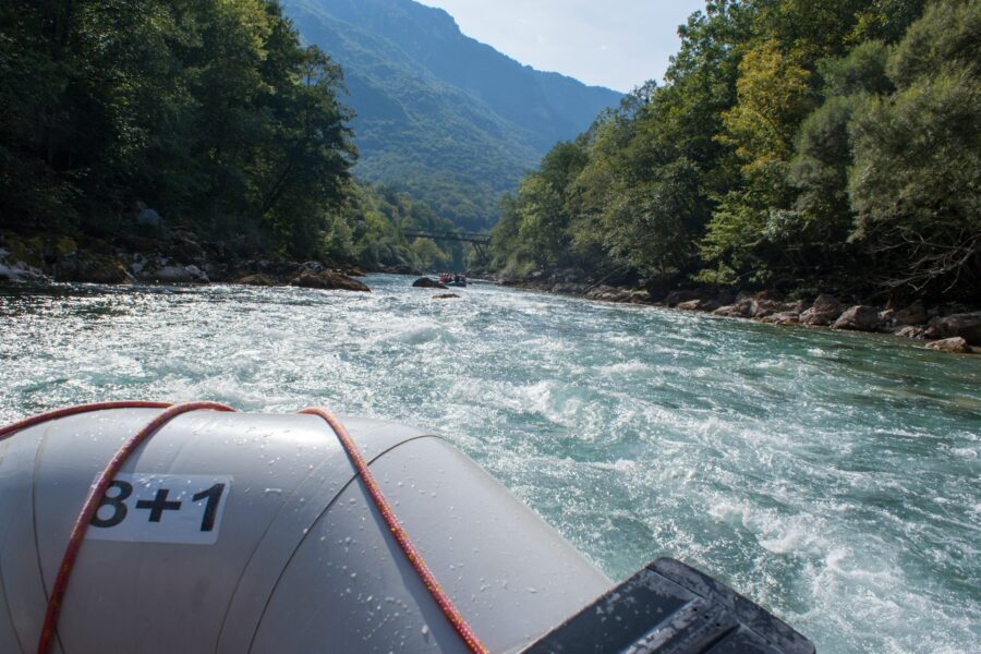
The night before a first Buffalo River float trip usually goes the same way. Someone has the gauge reading open on a phone, someone else is digging through a closet for river shoes, and the whole group is wondering whether tomorrow will be a lazy drift or a long scramble over gravel bars. The Buffalo rewards a little homework. Match the stretch to the season, check the water the morning you go, pack to the park’s rules, and floating the Buffalo River becomes one of the best days you can spend in the Arkansas Ozarks.
The Buffalo Runs on Rain
The most useful thing to know is that the Buffalo is not spring-fed. Its level rises and falls with rainfall, and the National Park Service describes a paddling season that usually opens on the upper river in spring and slides downstream as the months go by. In a wet year, the upper river stays floatable for much of the season. In a dry year, the good water moves quickly to the middle and lower river, and some stretches can run very low or even disappear underground.
The park’s paddling page lays the pattern out. The Upper District is usually navigable only in spring and early summer. The Lower District is typically floatable year round. The Middle District falls in between, depending on the year. Overall, use peaks from April through August, with the upper river busiest in April and May and the middle and lower sections at their busiest in June and July.
Picking a Section for Your First Float
Think of the river in three parts, and match the section to the month and to your group’s experience.
Upper District: Big Bluffs and Swift Water
The upper river is the showpiece, running through the Ponca Wilderness under towering bluffs. The park’s sample trip from Steel Creek to Kyles Landing covers 8 miles of alternating rapids and calm pools, passing Big Bluff, Jim Bluff and the mouth of Hemmed-In Hollow. It is spectacular. It is also the most rainfall dependent and most demanding stretch, and the shuttle road to Kyles Landing needs high clearance and four-wheel drive. Save it for a spring trip with decent water and at least one confident paddler in each boat.
When the top end is too low, the park suggests Pruitt to Hasty as a 7-mile backup. Look for Crow Hole, a shaded swimming spot at the base of Welch Bluff, where the rock layers have shifted about 100 feet along a fault.
Middle District: Room to Spread Out
Around Tyler Bend, the river opens into longer pools and wide gravel bars made for lunch stops and swims. For a quieter day in peak season, the park suggests lower-traffic stretches such as Carver to Woolum, going midweek, or launching early in the morning.
Lower District: The Easiest Bet for Beginners
Most first-timers find their rhythm on the lower river, the end of the park closest to north central Arkansas. A good introduction is Spring Creek to Dillard’s Ferry, a 4.6-mile float that takes about two to three hours at moderate levels. You drift past Jackpot, Kimball and Stairstep bluffs toward Water Creek, a fine place to beach the boat and explore, then take out at the Highway 14 bridge. Watch for Tie Chute, about half a mile below Water Creek, which can be tricky depending on the water. Spring Creek Landing is closed to vehicle launches, so plan to carry your boat between the parking area and the river.
Reading the Gauges
The park publishes clear limits for when the river is too high to float. Readings above these levels are considered unsafe:
- Ponca gauge: 1,600 cfs
- Pruitt (Highway 7) gauge: 2,000 cfs
- Grinder’s Ferry (Highway 65) gauge: 8,000 cfs
- Dillard’s Ferry (Highway 14) gauge: 9,370 cfs
Real-time readings come from the USGS gauges linked from the park website. Low water is the opposite problem: expect to climb out and drag your boat across gravel bars, and be prepared to shorten your plans. Thunderstorms can raise the river quickly even when the rain falls far upstream, so look at the forecast along with the gauge on the morning of your trip.
For timing, the park bases its trip estimates on a flow of about 2 miles an hour, and most visitors float 8 miles or less in a day. Every stop to swim, fish or poke around a gravel bar adds time, and those stops are half the fun.
Between river days, we’d be glad to give you a calm lake to come home to. A stay at Crown Lake Resort in Horseshoe Bend means a sandy beach, a sauna and an indoor heated pool for tired shoulders. Our lakefront stays put the water a few steps from your door, and the front desk at 800-872-3301 can match one to your group.
Packing to the Park’s River Rules
The Buffalo has a short list of river rules. The park’s river rules cover the essentials:
- Life jackets: Every person on a vessel needs a U.S. Coast Guard approved, properly sized life jacket, and children 12 and under must wear one, securely fastened, the whole time. The park recommends that older paddlers wear theirs too.
- Mesh litter bags: Canoes, kayaks, rafts and tubes that can swamp or tip must carry an attached, closeable mesh litter bag if there is any food or drink aboard.
- Sealed coolers and floating holders: Food and drinks ride in a sealed cooler, and any can or bottle outside it needs a floating holder so it won’t sink.
- No glass or foam: Glass is prohibited within 100 feet of any river or stream, and polystyrene coolers, cups and plates are banned while floating or camping along the river.
Beyond the rules, wear sturdy shoes that strap firmly to your feet. Gravel bars are rough, and loose sandals tend to float away the first time you step out of the boat. Tie gear down in waterproof bags, and in spring or fall wear wool or synthetic layers rather than cotton, with a waterproof shell on top.
Staying Safe Once You Launch
Most trouble on the Buffalo comes from a handful of predictable hazards. Fallen trees in or near the current, called sweepers and strainers, are the biggest. Give them a wide berth and never paddle into one. Slow down at narrow chutes and blind bends, where you may meet other boats, swimmers or even horses. If a boat pins against a rock or tree, do not try to free it. Get everyone safely to shore, leave the boat and report its location to a ranger.
Cell service along the river is unreliable. Leave a detailed plan with someone at home, including your put-in, take-out and expected return, along with the park’s 24-hour dispatch number, 1-888-692-1162. The park’s water safety guidance adds that cold water can bring on hypothermia quickly, so pack a change of clothes in a dry bag.
Anyone who would rather tube should keep it short: the park recommends tube trips of 1.5 miles or less, and a life jacket is a smart choice for every tuber.
Boats and Shuttles
There are no canoe rentals inside the park, and access points can be a long way apart by road. Sort out boats and your shuttle well before launch day. The park’s paddling page explains how rentals and shuttles work along the river. If you bring your own boats, the simplest plan is two vehicles, one left at the take-out.
Back at the Lake
A day on the Buffalo leaves a particular kind of tired: sun on your shoulders, sand in your shoes and a camera roll full of bluffs. Crown Lake Resort in Horseshoe Bend is a happy place to land afterward. Lodging guests can sink into the hot tub, spend a lazy next morning on the beach, or book a massage at L’Aura Spa & Wellness to work out the paddling knots.
For campers and motorhomes, the RV Resort has concrete pads, pull-thru sites and full hookups, plus canoe and kayak rentals if anyone in the group wants a practice paddle on flat water before the river.
If you’re still watching river levels and juggling dates, call us on 800-872-3301 and we’ll talk it through with you. You can browse our cabins and condos in the meantime and pick out the right spot for your group.
Frequently Asked Questions
Do I need a permit to camp on a gravel bar during a Buffalo River float?
No permit is required for backcountry camping along the river. Camp responsibly on gravel bars above the water line, and bury human waste in a cathole 6 to 8 inches deep and at least 200 feet from water, camps and trails, or pack it out in an approved bag system.
Can I bring my dog on a Buffalo River float trip?
Yes. Pets are allowed on the river, on gravel bars and in all park campgrounds, as long as they are kept under physical control at all times. Most park trails are closed to pets, so plan any side hikes accordingly.
How long is the Buffalo River?
The park’s paddling page puts the river at 151 miles, and about 135 miles of it lie within the national river’s boundary. Floats can be as short as a single mile or as long as 130 miles, so you can sample it in an afternoon or spend a week on it.
Where can I get current paddling conditions for the Buffalo River?
Call the Steel Creek Ranger Station at 870-861-2570 for the upper river, or the Buffalo Point Ranger Station at 870-449-4311 for the lower river. The park also recommends the Trails Illustrated Buffalo National River maps (West Half and East Half), which show bluffs and terrain in more detail than the basic park map.
Is the Buffalo River good for a multi-day float?
Yes. Multi-day floats with gravel bar camping are a classic way to experience the lower river, which is usually floatable all year. Plan resupply and shuttles carefully, since access points can be far apart.

Buffalo National River: How to Plan a Day There from Horseshoe Bend
The first time you see Painted Bluff rising over the swimming hole at Buffalo Point, the scale of the Buffalo National River catches up with you. You could spend a week here and still miss whole valleys. The park is a long, wild corridor of Ozark bluffs, gravel bars, hollows and old homesteads, and a great day trip comes from choosing one piece of it and doing that piece well. Do that, and you’ll still have energy left for the evening when you get back to Crown Lake in Horseshoe Bend.
The Country’s First National River
Congress set the Buffalo apart in 1972 as the first national river in the United States, and the National Park Service notes that approximately 135 miles of the free-flowing river lie inside the park boundary. The river rises in the Boston Mountains and runs mostly east until it meets the White River. Along the way it cuts through sandstone, limestone and dolomite, leaving bluffs that climb past 400 feet in places, with caves, sinkholes and springs scattered through the karst hills around them.
All that length is why planning matters. No road follows the river, because the Buffalo floods regularly, so each area is reached by its own highway and side roads. Some access roads are unpaved, rocky and better suited to high-clearance vehicles. The park also warns that GPS is unreliable here and has sent visitors down the wrong dirt roads, so carry an Arkansas highway map or the park map and check your route before you lose signal.
Pick One District
The park divides the river into three districts, each with its own gateway towns. The Upper District centers on Ponca and Jasper, the Middle District on St. Joe and Marshall along Highway 65, and the Lower District on Yellville and Harriet along Highway 14. The Lower District is the easternmost end of the park, which usually makes it the natural choice when you set out from Horseshoe Bend. The Upper District is the most dramatic, and it makes a fine full day if you leave early and accept a longer drive.
Lower District: Buffalo Point and Indian Rockhouse
Buffalo Point is the hub of the lower river. Its ranger station has a small theater showing the park film, exhibits, a bookstore and rangers at the information desk. The park’s Lower District day plan lists the station’s hours as Thursday through Monday, 9:00 AM to 3:30 PM, so confirm current hours if you are going midweek.
The Indian Rockhouse Trail is the hike to choose from here. It runs 3.5 miles with steep climbs and descents, past a sinkhole, a waterfall, an old mine prospect, Panther Creek and sculpted bedrock, and it ends at a bluff shelter that people used as early as 7,000 BC, according to the Park Service’s Lower District day plan. Dogs have to sit the Rockhouse out, since pets are not allowed.
Afterward, cool off at the Buffalo Point swimming beach, a deep pool beneath Painted Bluff with a small picnic area above the water. Park at the day-use access between the A and B campground loops, and keep a towel in the car for the drive home.
Middle District: Tyler Bend and Its Homesteads
Tyler Bend has the park’s main visitor center, open year round and sitting eight miles north of Marshall on Highway 65. Stop here for maps, current trail and road conditions, and advice on quieter corners of the park. The nearby Sod Collier Homestead gives a self-guided look at hill farm life, and the Spring Hollow, Buck Ridge and Rock Wall trails all start in the Tyler Bend area. Dogs are welcome on the Tyler Bend campground trails, so this district suits travelers who brought a pup.
Upper District: Elk, Waterfalls and Big Views
The Upper District is where the Buffalo earned its reputation. The Boxley Valley Historic District is known for Rocky Mountain elk grazing in the fields, and the park’s suggested Upper District day starts at sunrise, when your chances of seeing them are best.
Lost Valley is the classic family hike. The National Park Service rates it easy to moderate and kid friendly, taking about two hours on average. You pass a Natural Bridge where an 8-foot waterfall pours into an emerald pool, then Cob Cave, a bluff shelter about 200 feet wide, before reaching Eden Falls, a 53-foot cascade. The spur to the top of Eden Falls is steep and slippery, and the Park Service’s Lost Valley page notes it is one of the park’s most frequent search and rescue locations. Take that section slowly.
Stronger hikers can tackle Hemmed-In Hollow from the Compton Trailhead, about five miles round trip with a steep descent of nearly 1,400 feet. Its falls drop about 210 feet and only run after significant rain. The Centerpoint Trail to Big Bluff is similar in distance, with sweeping views over the river and a narrow, dangerous ledge called the Goat Trail at the end.
After a long day of trails, a warm pool and a quiet beach are a nice thing to come home to. At Crown Lake Resort, lodging guests can ease sore legs in the hot tub and the heated indoor pool, then wander down to the sand as the light fades. Our cabins range from cozy log cabins to a four-bedroom that sleeps twelve, and the front desk at 800-872-3301 can help you choose.
A Realistic Day Plan
A good Buffalo day has one anchor activity, one easy add-on and plenty of slack. In the Lower District, that might be the Indian Rockhouse Trail in the morning and a swim and picnic under Painted Bluff after lunch. In the Upper District, try elk watching at dawn, Lost Valley by mid-morning and a slow drive through Boxley Valley on the way out.
Start early. Ozark summer afternoons turn hot and sticky, and popular trailheads are calmer in the first hours of the day. Leave daylight for the drive home too. Rural roads in this part of Arkansas wind through hollows and over ridges, and they are much more enjoyable when you aren’t hurrying.
Bluffs, Caves and Water: Staying Safe
Most accidents at the park are preventable. Stay back from bluff edges, since rock can crumble. Swim with a buddy, never dive from cliffs, and remember that clear water is often deeper than it looks. The park has closed its caves to protect bats from white-nose syndrome (ask rangers about current status), and it asks visitors never to enter old mines.
Glass is not allowed within 100 feet of any water, including the river and smaller streams, so pack drinks in cans or refillable bottles. Cell service is unreliable through much of the park, so tell someone at home where you are going and when you expect to be back. If the river is running high and muddy after rain, the Park Service’s water and bluff safety page is a good reminder that swimming and wading can wait.
Wildlife and Dark Skies
Elk get the headlines, but the backcountry is also home to black bears, feral hogs and raccoons. Store food properly and watch animals from a respectful distance with binoculars. Pets are allowed on only a handful of park trails (Lost Valley and Indian Rockhouse are not among them), so read the park’s pet rules before bringing a dog.
If you can stay late, look up. The Buffalo became an International Dark Sky Park in 2019, the first park in Arkansas to earn the designation, and rangers lead summer night sky programs at Tyler Bend and Buffalo Point. On clear nights back home, the sky over Crown Lake puts on a show of its own.
Coming Back to Crown Lake
After hours of rocky trails and river air, it feels good to pull into Horseshoe Bend, where Crown Lake Resort sits right on the water in the center of town. Many guests alternate: a big outing one day, then a slow lake day of swimming, mini golf and scanning the sky for Crown Lake’s resident bald eagles. When nobody wants to cook after a long drive, Papa Dick’s Restaurant and pizzeria is on site.
At the RV Resort, full hookups at every site and dozens of pull-thru sites make an early start for the Buffalo that much easier. You can also explore the property before you arrive to picture how your days will flow.
We’d love to hear about your hike when you get back, so give us a ring on 800-872-3301 and we’ll find you a place to stay. Our cabins, condos and lakefront stays suit everyone from couples to big family groups, and the front desk is always glad to help with dates.
Frequently Asked Questions
Does Buffalo National River charge an entrance fee?
No. Buffalo National River does not charge an entry fee, so you can walk the trails, swim and sightsee without a pass. Camping in park campgrounds does carry a fee, and some pavilions, group sites and individual campsites can be reserved ahead of time.
Which Buffalo National River campgrounds take reservations?
Three campgrounds take reservations through recreation.gov: Steel Creek in the Upper District, Tyler Bend in the Middle District and Buffalo Point in the Lower District. Every other riverside campground in the park is first come, first served.
Can I ride a bike on Buffalo National River trails?
No. The park has more than 100 miles of maintained trails, and bicycles are banned on all of them. Trails marked with white blazes are for hikers only, while yellow-blazed trails are shared by hikers and horseback riders.
What number should I call in an emergency at Buffalo National River?
The park runs a 24-hour dispatch line at 1-888-692-1162. Because cell coverage is patchy, leave that number and your itinerary with a friend or family member before you head into the park.
Is there a lost and found at Buffalo National River?
Yes. Each district keeps one at its visitor contact station: Steel Creek Ranger Station for the Upper District, Tyler Bend Visitor Center for the Middle District and the Buffalo Point station for the Lower District.
Ash Flat, Arkansas: Errands, Supplies and Stops Near Crown Lake
It usually happens around day five of a longer stay. The cooler is down to condiments, someone needs a prescription refilled, the dog food bag is looking thin and the good coffee ran out yesterday. You have settled into an easy rhythm at the RV Resort at Crown Lake Resort, and nobody wants to spend a whole day on a supply run. For many guests in Horseshoe Bend, the answer is Ash Flat, Arkansas, the Sharp County seat and the area’s everyday errand town.
Why Ash Flat Is the Errand Town
The Encyclopedia of Arkansas entry for Ash Flat describes the town as a significant agricultural, medical and retail district that has served Sharp County since 1856. That role has hardly changed. It is still a busy retail center with stores that meet the needs of residents across the area, and it has grown into an important medical community with home health services and nursing homes.
So when you need groceries, household goods or everyday services, Ash Flat is where much of the surrounding countryside goes too. It is also the seat of county government and home to an extension of Ozarka College and the Sharp County Regional Airport. With 1,137 residents in the 2020 census, it is small enough that you won’t spend long finding your way around.
Check the Resort First
Before you start the engine, look at what’s already on site. The RV Resort has its own convenience store, and the property also has a KOA General Store and Papa Dick’s Restaurant and pizzeria. For ice, a snack or the bottle of sunscreen someone forgot, you may not need to leave at all.
For a bigger run, a list sorted by category gets you in and out quickly:
- Groceries and drinks for the next several days, including breakfast basics and something for the BBQ grill and picnic table at your site.
- Pharmacy and health items, including any prescription refills you can phone in ahead.
- Household and RV basics, such as paper towels, trash bags, cleaning supplies, batteries and a spare hose washer or two.
- Pet supplies if a dog is traveling with you.
- Fuel for the tow vehicle or the rig, so the next day trip starts with a full tank.
Store hours vary, especially on Sundays and holidays, so look them up before you go and call ahead if you are hunting for something specific.
For a longer stay, we’d love to have you at Crown Lake KOA Holiday, right on the water in Horseshoe Bend. Sites come with electric, water and sewer hookups, WiFi, a picnic table and a BBQ grill, and at most sites you’ll also find direct connect Ethernet plus full HD cable. Have a look at our RV sites, and if you’re not sure which one suits your rig, call us on 800-872-3301.
Making the Supply Run Painless
Go Early
Weekday mornings tend to be the calmest time for errands in any small town. Leave after breakfast, get back by lunch, and the afternoon is yours for the beach, the pool or a paddle.
Pack for the Heat
Bring a couple of insulated bags or a cooler for cold and frozen goods. Ozark summer afternoons get hot, and nobody wants melted ice cream on the way back.
Add Something Fun
Ash Flat sits on a four-lane highway serving the Hardy, Highland and Ash Flat area, so a supply run links easily with a stroll down the historic Main Street in Hardy or a drive through Cherokee Village. Suddenly the chore is a half-day outing.
Health and County Services
Longer stays sometimes bring surprises, from a forgotten medication to a minor illness. Because Ash Flat has grown into a medical community, it is a sensible first place to look for health services nearby, and it helps to know what’s there before you need it. Keep insurance cards and a list of your medications with you. In an emergency, call 911.
County business happens here as well. The Encyclopedia of Arkansas entry on Sharp County explains that a community center with court areas was built in Ash Flat in 1963, and an annex added in 2003 holds offices for the circuit judge, the prosecuting attorney and the sheriff.
A Few Stops While You’re in Town
The Veterans’ Memorial
Ash Flat’s veterans’ memorial was built in 2006 to honor veterans from all of the nation’s wars. It is a peaceful place to pause, and a meaningful one for veterans and military families staying with us.
The Sharp County Fairgrounds
Sharp County has held a county fair for decades, and its fairgrounds sit three miles south of Ash Flat on twenty acres. If your stay lines up with fair season, go and see a slice of rural Arkansas at its most cheerful. Check local listings for dates.
How the Town Got Its Name
Farmers settled the area in the 1820s, when Arkansas was still a territory. A post office opened in 1856, and a group of residents led by postmaster James McCord named the town for a nearby grove of ash trees. By 1871 there were about 150 residents, a blacksmith shop, three stores, two saloons and a cotton gin.
For more than seventy years Sharp County had two county seats, one in Hardy and one in Evening Shade. In 1967 the Arkansas General Assembly ended that arrangement and made Ash Flat the seat of the combined county, which gave the town a lasting boost. One native son went on to lead the state’s flagship university: David W. Mullins, born in Ash Flat in 1906, was president of the University of Arkansas from 1960 to 1974.
Bringing the Dog
Dogs are welcome at the RV Resort, and its dog park is just right for an evening run. Stock up on enough food and treats in Ash Flat to last the trip. If you’re staying in a cabin or condo, check the current pet policy with the front desk when you book.
Back at Camp
Once the groceries are stowed, the lake takes over again. Cool off at the swimming dock, rent a canoe for an hour, or book a pontoon by calling 870.750.0700 and spend the evening out on Crown Lake. The explore the property page has the full list of what’s on site.
However long you’d like to stay, the front desk at 800-872-3301 is happy to help you sort out the details. RV guests can reserve through our RV Resort page. If some of your group would rather have a roof and a porch, we have cabins and condos on the same property, including the cozy 1 BR 1 BA Log Cabin with Porch. Seasonal front desk hours are on the contact page.
Frequently Asked Questions
When did Ash Flat become the Sharp County seat?
In 1967. That year the Arkansas General Assembly abolished Sharp County’s two county seats at Hardy and Evening Shade, and Ash Flat, sitting between the two, became the seat of the combined county.
How did Ash Flat, Arkansas get its name?
Residents led by postmaster James McCord chose the name in 1856 because of a grove of ash trees nearby. The name stuck as the farming community grew into a trading center.
Does Ash Flat have an airport?
Yes. Ash Flat is home to the Sharp County Regional Airport, which can be useful for travelers arriving by private plane.
Is there a college in Ash Flat?
Yes. Ozarka College opened an extension in Ash Flat in 2001, offering two-year college courses closer to home for Sharp County residents.
When was Ash Flat incorporated?
Ash Flat was incorporated on May 8, 1931, although the community itself dates back to the post office founded in 1856.
Salem, Arkansas: A Small-Town Stop Near Horseshoe Bend
In 1839 a War of 1812 veteran named William P. Morris came into the hills of north central Arkansas holding a land grant he had earned for his service. He chose his claim near a prominent hill. That hill is Pilot Knob, and the town that grew at its foot is Salem, Arkansas, now the seat of Fulton County and a pleasant country drive north of Horseshoe Bend and Crown Lake Resort.
Don’t come expecting big attractions. Salem is an hour or two of small-town Ozark life, a courthouse square with a long memory, a ballpark with a major-league connection and a clear fork of the Spring River at the edge of town. Its past turns out to be far more dramatic than its quiet streets suggest.
Salem at a Glance
- County: Fulton County, which it has served as county seat since 1844.
- Population: 1,566 in the 2020 census.
- Elevation: 714 feet.
- Landmark: Pilot Knob, the hill that first drew settlers and gave the town its original name.
- Water nearby: The South Fork of the Spring River runs along the town’s northeastern edge, and the Strawberry River is close by.
The Story Behind the Square
The Encyclopedia of Arkansas entry on Salem records that the Arkansas General Assembly organized Fulton County in 1842, and the spot that is now Salem was chosen as county seat on July 4, 1844. A one-room log house went up on the public square to serve as the seat of justice. The first post office opened that same year under the name Pilot Hill, after the knob above town.
That log courthouse was replaced before the Civil War by a larger log building, which burned during the war. A later courthouse, along with every county record, was lost to another fire in 1870, and the present courthouse was built soon after. When you stand on the square, you are standing on the spot where Fulton County has done its business for more than 180 years.
One stone building from the early 1900s still stands nearby, a reminder of how many times this town has had to rebuild.
A Name That Means Peace
The Civil War was hard on Fulton County. On March 13, 1862, Union cavalry clashed with Confederate forces in a swampy area northeast of town, in what is known as the Action at Spring River and sometimes called the Battle of Salem. The fight lasted about four hours. Raiders and guerrilla bands roamed the county afterward, and fire destroyed nearly all of the town. The encyclopedia records that a single log cabin survived.
Residents rebuilt, and on February 20, 1872, the town’s name officially changed from Pilot Hill to Salem. The Encyclopedia of Arkansas entry on Fulton County explains that Salem means “city of peace” in Hebrew, a choice that says plenty about what those families had lived through.
That spring of 1862 left one more mark. On April 29, after the Battle of Pea Ridge, the Union Army of the Southwest under Major General Samuel Ryan Curtis crossed into Arkansas from Missouri near Salem.
A morning in Salem and an afternoon on the sand make a good pairing, and we’re happy to help you set it up. Our condos include units right by the beach and outdoor pool, so the kids can be in the water within minutes of getting back. Call the front desk on 800-872-3301 and tell us who’s coming.
Things to Do in Salem, Arkansas
Walk the Square
Start where the town started. Park near the courthouse and take a slow lap, looking at the older stone and brick buildings and the businesses that serve the county today.
Look Up at Pilot Knob
You can spot Pilot Knob from around town. It gave the community its first name, and once you see it you understand why Morris settled here nearly two centuries ago.
Visit Preacher Roe Park
Salem’s ballpark has a major-league story. Elwin “Preacher” Roe, who grew up nearby, pitched for the St. Louis Cardinals, the Pittsburgh Pirates and the Brooklyn Dodgers, where he was a teammate of Jackie Robinson. The Fulton County entry notes that Roe developed Preacher Roe Park in Salem and pitched an exhibition game there every fall for its first eight years. If a local game is on while you’re in town, grab a seat in the stands for a proper small-town evening.
Spend Time by the South Fork
Clear water flows past the northeastern side of town. The encyclopedia notes that the South Fork offers fishing and floating, as does the nearby Strawberry River. Even without a rod or a canoe, a few minutes on the bank is a calm way to finish a visit.
Dig Into Local History
Salem has had a weekly newspaper since 1876, and the Fulton County Historical Society has published its Fulton County Chronicles from Salem since the 1980s. History lovers can ask in town about the society’s resources and old photographs. Small communities tend to keep their stories close, and people are often glad to share them with someone who asks.
A Few Facts to Share on the Drive
- Salem was incorporated in 1900, then reincorporated in 1927 with an elected mayor and council after a stretch with no governing body.
- The town had no electric lights until 1928. The first power plant switched off at 11 p.m. each night and came back on at 6 a.m.
- Salem’s first telephone lines, strung in 1890, ran all the way to Mammoth Spring.
- A tornado tore through residential Salem in January 1947, but the business district and school were spared.
Practical Notes for Longer Stays
Guests staying a week or more on Crown Lake may find the county seat handy to know. Fulton County Hospital opened in Salem in March 1963, and the encyclopedia notes it is one of the last county-owned hospitals operating in Arkansas. County offices and the courthouse are here too, along with the everyday businesses that serve residents across the area.
How Salem Fits Into Your Trip
Salem pairs well with other stops in Spring River country. Head northeast to Mammoth Spring State Park, where the river begins, or east to Cherokee Village and the historic Main Street in Hardy. Any one of them fills a morning, and stringing two together gives you a real sense of this corner of the Ozarks.
Afterward, the lake is waiting. Some families spend the rest of the day on the beach with a paddleboard, others go straight for the indoor pool or a round of Safari Mini Golf. Our explore the property page shows everything you can do without getting back in the car.
Give us a call on 800-872-3301 and we’ll help you plan a few unhurried days around Horseshoe Bend. Families often like the 2 BR 2BA Pool Beachfront Condo, which sleeps six close to the sand, the pool and the children’s playground. If you’re towing a camper, our RV sites have electric, water and sewer at every pad. You’ll find more about the resort on the Crown Lake Resort homepage.
Frequently Asked Questions
Which county is Salem, Arkansas in?
Salem is the county seat of Fulton County in north central Arkansas. The county was established in 1842 and borders Missouri to the north.
What was Salem, Arkansas called before?
The town was known as Pilot Hill, after the post office established there in 1844 and the large hill overlooking it. The name officially changed to Salem on February 20, 1872.
Is there a hospital in Salem, Arkansas?
Yes. Fulton County Hospital has operated in Salem since March 1963. It was built with the help of a rural hospital grant, local doctors and a voter-approved county tax.
What rivers are near Salem, Arkansas?
Two. The South Fork, a branch of the Spring River, flows along the northeast side of Salem, and the Strawberry River lies nearby. Both offer fishing and floating.
How many people live in Salem, Arkansas?
The 2020 census counted 1,566 residents. The population roughly doubled between 1960 and 1980, helped by new jobs at the county hospital and a shirt factory.
- ‹ Previous
- 1
- 2
- 3
- 4
- Next ›
